 Directions by Sea From the West Directions by Sea From the West
Longitude: 73¬ƒ46'91 W
Lattitude: 40¬ƒ50'75 N
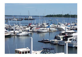
Follow the East River to The Throgs Neck Bridge. After clearing the bridge, with R "48" to your port, head almost due north to City Island. Proceed up the East Side of the island approximately 1/4 nm. The entrance to our breakwater is just a short distance North of the Floating Barge and row of Pilings which will be on your port side. We are approximately 0.7NM West of the Fl R 4S "46" just off the Southern Tip of Hart Island. Contact our Dockhands on VHF Channel 69.
Note: The above instructions are approximate and should not take the place of your own up-to-date nautical charts.
|

